A map that helped govern an empire showcased at the "Geography Lessons" exposition
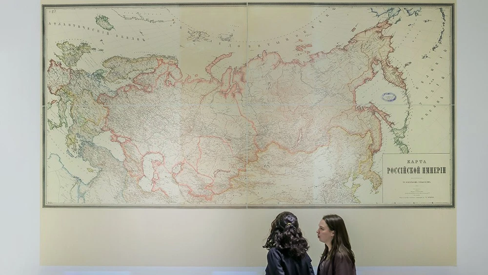
Visitors to the National Centre RUSSIA can now view a defining map of the late Russian Empire as part of the "Geography Lessons" exposition. Dating from 1882, this map was produced by the Alexei Ilyin Cartographic Establishment — Russia's first specialised cartographic firm. By the late 19th century, this institution was responsible for nearly 90% of the civilian cartographic output across the country.
This large-format map showcases the peak of 19th-century cartographic science. Every detail is rendered with precision: the borders of the Regions and the Provinces, the capital and provincial centres, and a vast network of cities and districts. It clearly delineates rivers, mountain ranges, coastlines, postal routes, and railways. Unlike the maps of the 18th century, there are no "white spots" to be found; the imperial territory has been meticulously surveyed, measured, and documented.
Of particular note is the disclaimer "based on the latest data". This signifies that the map was compiled using the most advanced sources of the era: geodetic surveys, military topographical data, and findings from scientific expeditions. It is more than a mere illustration; it is the result of a sophisticated state system for spatial management. Used by officials, military officers, engineers, and teachers alike, such maps became indispensable tools for strategic planning and administration.
The Alexei Ilyin Cartographic Establishment, founded in 1859, reached a scale of millions of prints per year by the 1880s, producing everything from general atlases to educational materials. At the All-Russian Manufacturing Exhibition of 1882, the firm was granted the prestigious right to feature the state emblem on its products — a testament to its official recognition and the quality of its work.
The 1882 map and other rare artefacts are currently on display in the "Map Gallery" hall. This is where visitors begin their journey into how the country’s borders, names, and geographical identity have shifted over the centuries.
"Geography Lessons" is a flagship project of the National Centre RUSSIA. It offers a journey through time: from ancient scrolls to modern digital cartography, and from the earliest discoveries to space exploration and the transport systems of tomorrow. the National Centre RUSSIA features unique materials curated from the nation’s premier archives. The exposition is open to the public; visitors may join a guided group by registering on the National Centre RUSSIA website or explore independently with an audio guide.

The III All-Russian Wedding Festival "Russia. Uniting Hearts" brings together couples from across the country.

Today, every unusual flavour combination is driven by technology, experimentation and the search for new sensations.